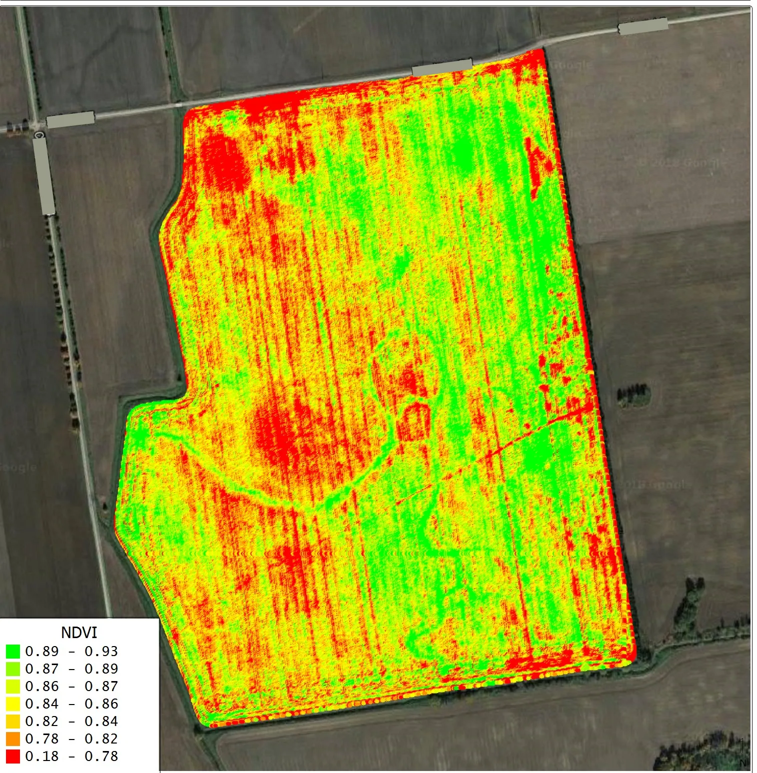
Photogrammetry & Orthomosaic Mapping
Creating detailed 2D orthomosaic maps and 3D models from drone data. Provides precise, georeferenced maps crucial for detailed site analysis, planning, and verification.
Problem, solution & outcomesExperience innovative drone services tailored for your construction and commercial needs, maximizing your project efficiency and delivering exceptional aerial visuals.
At Agriflyte, we believe that better data leads to better decisions, and that every construction project and development site in Oklahoma deserves to be seen clearly from above.
Agriflyte was founded by a University of Oklahoma student who saw a simple problem: the industries that build Oklahoma were making critical decisions with incomplete information. Site managers walking muddy lots, developers relying on outdated surveys, project managers without a clear picture of progress. We built Agriflyte to change that.
Location & Mission
We are an FAA Part 107 certified drone services company based in Norman, Oklahoma, serving the greater OKC metro area. Our mission: to give Oklahoma’s builders and developers the aerial perspective they need to work smarter, move faster, and build with confidence.
Founded in Norman
Built by an Oklahoman, for the people who build Oklahoma.
We give contractors and developers a clearer picture of their job site, when they need it, not when it’s convenient. Using professional-grade DJI drone technology, we capture detailed aerial documentation, photogrammetry maps, and progress reports that keep your project on track and your team informed.
Unlike traditional survey methods, our drone data is faster to collect, easier to interpret, and immediately usable for decision-making. Whether you’re tracking site progress, measuring stockpile volumes, or documenting conditions for liability protection, Agriflyte delivers precise aerial intelligence with a local, hands-on approach.
Georeferenced 2D map · 1.2 cm/px GSD
Drag to compare
1.2 cm/px
Ground sample distance
±1.2%
Volume accuracy
24–48h
Deliverable turnaround
Every engagement is flown by a certified pilot, processed in-house, and delivered in formats your team already uses. Open any service for the problem it solves, how we work, and the numbers.

Creating detailed 2D orthomosaic maps and 3D models from drone data. Provides precise, georeferenced maps crucial for detailed site analysis, planning, and verification.
Problem, solution & outcomes
Comprehensive aerial surveys conducted before construction begins. Captures detailed imagery to establish a baseline for progress monitoring and identifying existing conditions.
Problem, solution & outcomesDocumenting project evolution from groundbreaking to completion. Provides regular aerial updates to highlight key milestones and identify issues early.
Problem, solution & outcomesAccurate aerial measurement of material stockpiles. Utilizes advanced photogrammetry to provide precise volume calculations, aiding in inventory management and cost control.
Problem, solution & outcomes
High-resolution aerial photography and videography for commercial properties. Showcasing developments, real estate, and business locations from unique aerial perspectives.
Problem, solution & outcomes
Utilizing specialized multispectral sensors to capture data beyond visible light. Provides insights into crop health and variability, empowering data-driven farming decisions.
Problem, solution & outcomesDrones are aircraft, subject to strict federal regulations. You can’t simply buy a drone and fly it right away. Our team of certified pilots ensures that all operations comply with regulations, with safety as our top priority.
Authorization is equally important. Every flight is planned, risk-assessed, and executed with full regulatory compliance. We operate on and around active job sites, and we take that responsibility seriously — no shortcuts, no exceptions.
When you work with Agriflyte, you get a professional who shows up prepared, communicates clearly, and delivers data you can actually use.
Schematic for illustration only — not for navigation. Nearly every job site in this metro sits under or beside controlled airspace, which is exactly why authorization is part of the job, not an afterthought.
Flight Protocol
Certified pilots only
Drones are aircraft. Every Agriflyte flight is commanded by an FAA Part 107 certificated remote pilot — not a hobbyist with a controller.
Airspace authorization
Controlled airspace is cleared through LAANC before wheels-up. If a flight needs a waiver, we file it and wait for it.
Pre-flight risk assessment
Weather, obstructions, crew locations and overflight paths are documented for every mission, on every site.
Active job site discipline
We coordinate with your superintendent, stay clear of crews and equipment, and follow site PPE and access rules without exception.
Need our certification details for your prequalification packet?
Request DocsWe’re local. That means same-week scheduling, no travel line item, and a pilot who already knows the airspace over your site. Regular coverage runs roughly 60 miles out of Norman — farther for the right project.
Cities we fly
Counties
Something not covered here? Email deyan@agriflyte.com and you’ll get a real answer, not a brochure.
Tell us about the site and what you need to see. We’ll come back with a flight plan, a deliverable list, and a flat quote — usually the same day.