
Agricultural Multispectral Imaging
Utilizing specialized multispectral sensors to capture data beyond visible light. Provides insights into crop health and variability, empowering data-driven farming decisions.
- 5 bands
- Captured per pass
- 160 acres
- Per flight window
- 10–20%
- Typical input savings
- 2 weeks
- Earlier stress detection
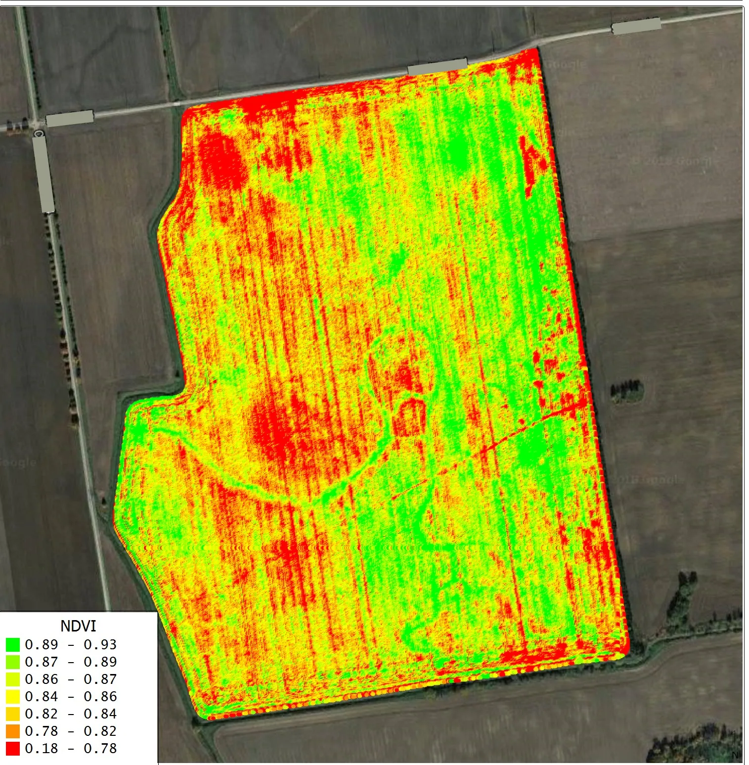
Representative deliverable
In short
Agricultural multispectral imaging captures red, green, red-edge and near-infrared light to produce calibrated NDVI and NDRE maps that reveal crop stress before it is visible to the eye. Agriflyte flies multispectral missions for Oklahoma row-crop producers and agronomists, covering a full quarter section in one flight.
Built for the people who have to make the call.
Row-crop producers
Find the problem acres before they cost yield.
Agronomists & retailers
Zone maps to build prescriptions on.
Co-ops
Consistent field data across a lot of grower acres.
Ranchers
Pasture and forage vigor without driving every fence.
The field is not uniform, but the applicator treats it like it is.
Stress shows up in the near-infrared long before it is visible from the cab. By the time a thin spot is obvious at eye level, the yield is already gone. Meanwhile uniform-rate application spends the same money on the acres that need it and the acres that do not.
- Scouting hundreds of acres on foot and still missing the pattern
- Uniform rates across ground with obvious variability
- Stress found weeks after it started costing bushels
- No consistent record of how a field responded across a season
Five bands of data, turned into zones you can actually apply.
A multispectral sensor captures red, green, red-edge and near-infrared alongside RGB. We process it into calibrated NDVI and NDRE maps, then reduce them to management zones you can hand to an agronomist or load into a controller — with flights timed to growth stages so you can watch a field respond.
- Calibrated multispectral capture with reflectance panel reference
- NDVI, NDRE and custom index maps per flight
- Management-zone delineation for variable-rate application
- Repeat flights at key growth stages for in-season comparison
What it changes, in numbers.
5 bands
Captured per pass
R, G, red-edge, NIR + RGB
160 acres
Per flight window
a full quarter section
10–20%
Typical input savings
reported in variable-rate field trials
2 weeks
Earlier stress detection
typical vs. visible-light scouting
Figures are capability specifications and typical ranges for this service — actuals vary with site conditions, control and material. We put project-specific numbers in every quote.
Deliverables, in formats your team already opens.
Specifications
- Bands
- Red, green, red-edge, near-infrared, RGB
- Calibration
- Reflectance panel every flight
- Coverage
- 120–200 acres per flight window
- Outputs
- GeoTIFF, shapefile, controller-ready zones
- Timing
- Scheduled to growth stages through the season
Four steps from your call to usable data.
- 1
Field and season plan
Which fields, which growth stages, and what decision the data has to support.
- 2
Calibrated capture
Multispectral flight with panel calibration so flights are comparable to each other.
- 3
Index processing
NDVI, NDRE and any custom index, plus zone delineation.
- 4
Prescribe and repeat
Zones to your agronomist or controller, then re-fly to see the response.
What people ask before they book this.
Something not covered here? Email deyan@agriflyte.com and you’ll get a real answer, not a brochure.
- What does multispectral imaging show that regular drone photos do not?
- Multispectral sensors record red-edge and near-infrared reflectance, where crop stress appears well before it is visible to the eye. Calibrated NDVI and NDRE maps built from those bands reveal nutrient deficiency, compaction, drainage problems and stand issues while there is still time in the season to act.
- How many acres can you cover in one multispectral flight?
- Agriflyte covers 120–200 acres per flight window, which is a full quarter section in a single mission. Larger operations are flown field by field on a schedule tied to growth stages so each flight is comparable to the last.
- Can the maps be loaded into a variable-rate controller?
- Yes. Agriflyte delivers management-zone shapefiles alongside the NDVI, NDRE and RGB layers, so your agronomist or retailer can build a prescription and load zones directly into a rate controller. Variable-rate trials commonly report 10–20% input savings against uniform application.
Need this on a site in the OKC metro?
Send the parcel and what you need to see. You’ll get a flight plan, a deliverable list and a flat quote — usually the same day.